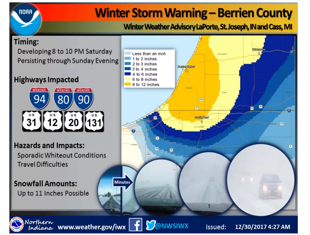
If you are on the receiving end of Michigan Department of Transportation notices, you cell phone is likely blowing up with alerts regarding sections of major highways that are being blocked with increasing regularity this afternoon highlighting wrecks that have taken place from the state line north into Van Buren County today on a very blustery day that is proving difficult to maneuver in. A broad section of Berrien is expected to add on as much as an extra foot of snow between now and New Year’s Eve night.
Business, organization and event closings are also starting to filter in as the weather worsens, even before a National Weather Service Winter Storm Warning even goes into effect. That doesn’t start until this evening according to the NWS office in Northwest Indiana. Here is their message:
WINTER STORM WARNING IN EFFECT FROM 8 PM THIS EVENING TO
MIDNIGHT EST SUNDAY NIGHT,WHAT,Heavy lake effect snow expected. Plan on difficult
travel conditions. Total snow accumulations of 6 to 9 inches,
with localized amounts up to 11 inches, are expected.WHERE,Berrien County.WHEN,From 8 PM this evening to midnight EST Sunday night.
ADDITIONAL DETAILS,Be prepared for significant reductions in
visibility at times.PRECAUTIONARY/PREPAREDNESS ACTIONS,
A Winter Storm Warning for heavy lake effect snow means
significant amounts of lake effect snow are forecast that will
make travel very hazardous or impossible. If you must travel,
keep an extra flashlight, food, and water in your vehicle in case
of an emergency. The latest road conditions for the state you are
calling from can be obtained by calling 5 1 1.
The NWS says that the lake effect snow will develop and intensify late tonight and continue through Sunday evening, creating significant travel difficulties. Snow will also spread inland and affect Laporte, St. Joseph Counties in Indiana and Cass County Michigan. Elsewhere across the region light snow will linger through the day. Another surge of cold air will charge through the region Sunday through Tuesday bringing dangerous wind chills.
Here is a link to the latest closings and delays: https://www.moodyonthemarket.com/closings/
MDOT’s alert system is forging into overtime with continual updates on incidents blocking single lanes in some circumstances to incidents blocking all lanes in others. Jack-knifed semis and cars following one another into the ditch continue to keep emergency crews, wreckers and companies like AAA very busy. If you are going to venture out, be prepared for extended travel times, whiteout conditions, slow going, and the possibilities of roadblocks and other hazards along the way.


